Catamarca
Explora Nuestras Provincias y sus Riquezas is part of Argentina al Mundo, alongside Argentine Delights, Guía AD-Gourmet and Chefs Argentinos al Mundo.
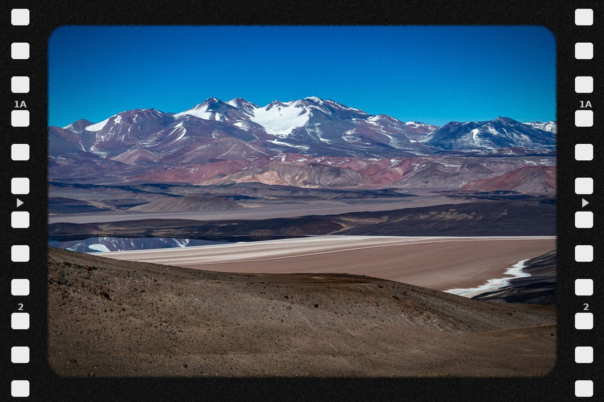
Catamarca, land of volcanoes. Along the Route of the Six-Thousanders rise some of the highest volcanoes on the planet, led by Ojos del Salado. In the Puna, the Campo de Piedra Pómez is a white sea sculpted by the wind, and in Tatón, the Federico Kirbus dune is considered the highest in the world. Ponchos woven in Belén, faith in the Virgen del Valle, and walnuts, olives and high-altitude wines. Catamarca cannot be described: it must be discovered. Catamarca is the Earth before time.

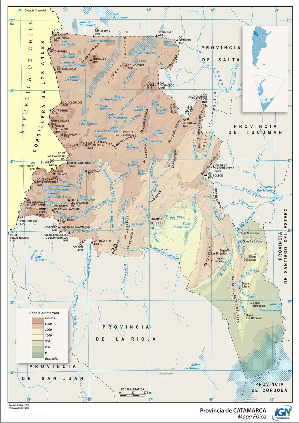
Political map · Source: IGN
- Capital
- San Fernando del Valle de Catamarca
- Region
- Northwest
- Area
- 102,602 km²
- Population · 2022 Census
- 429,562 inhabitants · 4.2 hab/km²
- Women · Men
- 51.0 % · 49.0 %
- Median age
- 31 years
- By age
- 0 to 14 years: 22.2 % · 15 to 64 years: 67.7 % · 65 years and over: 10.1 %
- Climate
- Arid and semi-arid; cold at altitude in the Puna; temperate highland in the valleys and gorges.
- Demonym
- catamarqueño/a
- Founding of the capital
- 5 July 1683
- World Heritage (UNESCO)
- Qhapaq Ñan, Sistema Vial Andino (2014)
- Status
- Province predating the 1853 National Constitution
- Departments
- 16
- Born in another province · abroad
- 14.5 % · 0.5 %
Sources: INDEC, 2022 National Census (final results) · INDEC / IGN (area). World Heritage: UNESCO, World Heritage List · Provincialization laws · IGN (political division).
- Mean annual temperature
- 21.0 °C
- Annual rainfall
- 411 mm
- Mean maximum · warmest month
- 34.6 °C · January
- Mean minimum · coldest month
- 4.5 °C · July
Source: Servicio Meteorológico Nacional (SMN), climatological standard normals 1991–2020, station Catamarca Aero, submitted to the World Meteorological Organization.
- Highest point
- Complejo Volcánico Ojos del Salado · 6,879 m · on the border with Chile
- Main rivers
- Del Valle · Santa María · Abaucán
- Ecoregions
- High Andes · Puna · Monte of Sierras and Bolsones · Yungas Forest · Dry Chaco
- Main cities
- San Fernando del Valle de Catamarca · San Isidro · Belén · Tinogasta · Andalgalá
Sources: Instituto Geográfico Nacional (IGN), highest elevations · Secretaría de Infraestructura y Política Hídrica de la Nación, river basins · Ministerio de Ambiente de la Nación, ecoregions of Argentina · INDEC, 2022 National Census (population by department).
- Hotel guests · 2024
- 64,902 in San Fernando del Valle de Catamarca · 4.1 % from abroad
Sources: INDEC and Secretaría de Turismo de la Nación, Hotel Occupancy Survey (hotels and other lodgings) · Administración de Parques Nacionales.
- Airport
- Coronel Felipe Varela · 79,777 passengers in 2025
- Scheduled flights · 2025
- Aeroparque 72,180 · La Rioja 7,597 passengers
- National routes
- RN 38 · RN 40 · RN 60 · RN 64 · RN 79 · RN 157
- International border crossings
- Chile 1
Sources: Secretaría de Turismo de la Nación, Air connectivity, with ANAC data · Instituto Geográfico Nacional (IGN), national road network and international crossings.
- From San Fernando del Valle de Catamarca to the City of Buenos Aires, by road
- 1,155 km
To the other provincial capitals, by road
- La Rioja 156 km
- Santiago del Estero 212 km
- San Miguel de Tucumán 232 km
- Córdoba 440 km
- Salta 539 km
- San Salvador de Jujuy 572 km
- San Juan 606 km
- San Luis 705 km
- Santa Fe 770 km
- Mendoza 773 km
- Paraná 801 km
- Resistencia 822 km
- Corrientes 855 km
- Formosa 988 km
- Santa Rosa 1,040 km
- Posadas 1,160 km
- La Plata 1,188 km
- Neuquén 1,588 km
- Viedma 1,634 km
- Rawson 1,895 km
- Río Gallegos 3,075 km
- Ushuaia 3,668 km
Source: Government of the Argentine Republic (argentina.gob.ar), road distances between provincial capitals.
- National festivals
- Fiesta Nacional e Internacional del Poncho · July
- Traditional festivals
- Fiesta de la Virgen del Valle · April and December
Sources: Ley nacional 26.757 · Ley nacional 27.332 · Visit Catamarca (portal oficial de turismo).
- Share of the national economy · 2024
- 0.7 % · rank 22 of 24
- Growth 2004–2024
- -1 % · the country, +42 %
- Main activities
- Public administration 13.3 % · Trade 12.1 % · Metal mining 9.7 % · Communications 7.9 %
Source: ECLAC and Ministerio de Economía de la Nación, Provincial breakdown of gross value added, 2004 base (2023 and 2024, preliminary data).
Natural wealth
The territory that defines it
Catamarca is a high-altitude land. In its west, the Andes bring together the country's largest concentration of peaks above six thousand meters —the Route of the Six-Thousanders, from Fiambalá— and Ojos del Salado, on the border with Chile, the highest volcano in the world, at more than 6,800 meters. In the Puna of Antofagasta de la Sierra lie the Campo de Piedra Pómez, a white sea of volcanic rock sculpted by the wind, and the high Andean lagoons, a Ramsar site of more than 1.2 million hectares. Lower down, the valleys and basins of Belén, Tinogasta and Andalgalá, with their dunes and hot springs, and the central valley, where the capital lies.
- Lagunas altoandinas y puneñas de Catamarca (2009) · 1,228,175 ha
Source: Argentine Undersecretariat of Environment, Ramsar Sites Network. Official year of designation and area.
Human wealth
The living figures
Catamarca is devotion and craft. The Virgen del Valle, its patron saint, draws thousands of pilgrims to the capital every year. In Belén, the National Poncho Capital, weavers keep the loom alive with llama, sheep and vicuña wool, and every July the National and International Poncho Festival brings together artisans, music and food from all over the province. The Diaguita heritage beats in the valleys, and the table offers empanadas, locro, walnuts, olives, quince sweets and high-altitude wines.
- 6th to 10th centuries · the La Aguada culture flourishes, famous for its pottery and metalwork
- 15th century · the Inca Empire builds El Shincal de Quimivil, near Londres, one of its main administrative centers in the south of the Tawantinsuyu, connected to the Qhapaq Ñan
- 16th and 17th centuries · the Diaguita peoples of the valleys resist the conquest in the Calchaquí Wars
- 1683 · San Fernando del Valle de Catamarca is founded
- 1853 · the Catamarca friar Mamerto Esquiú delivers his sermon in defense of the National Constitution; he was beatified in 2021
Sources: Government of the Province of Catamarca · Argentine Episcopal Conference.
19,668 people identify as Indigenous or as descendants of Indigenous or native peoples: 4.6 % of the province's population. They belong to 41 different peoples, and 3,428 (17.4 %) speak or understand the language of their people. The five largest peoples are:
- Diaguita · 11,919
- Diaguita Cacano · 351
- Kolla · 290
- Kolla Atacameño · 230
- Quechua · 153
Source: INDEC, 2022 National Population, Household and Housing Census, final results. Population in private dwellings.
Productive wealth
What it produces and exports
Catamarca is today a mining province: lithium from the Salar del Hombre Muerto and Fiambalá leads its exports, together with gold and silver. They coexist with an agricultural tradition of olive, walnut and grape growing in the valleys. China is its main buyer, with more than half of its exports.
USD 402 million, 22.2 % more than in 2024: 0.5 % of the national total and 8.0 % of the Northwest.
- Manufactures of industrial origin · USD 366 M
- Primary products · USD 24 M
- Manufactures of agricultural origin · USD 12 M
Main destinations: China (USD 207 M, 51.4 %), United States (USD 84 M), Indonesia (USD 8 M) and Brazil (USD 5 M). Main products: chemicals and related products (amount withheld for statistical confidentiality), precious stones and metals and their manufactures, coins (USD 76 M), oilseeds and oleaginous fruits (USD 11 M) and cereals (USD 9 M).
Source: INDEC, Provincial origin of exports. Goods. Year 2025 (provisional data) and annex tables.
Four projects in production in the Puna:
- Fénix, Salar del Hombre Muerto · Rio Tinto · lithium carbonate
- Tres Quebradas, Fiambalá · Zijin-Liex · lithium carbonate
- Sal de Oro, on the border with Salta · Posco
- Hombre Muerto Oeste · Galan Lithium · first lithium chloride in 2026
Fénix, Tres Quebradas and Hombre Muerto Oeste were approved under the RIGI to expand their production.
Sources: Argentine Secretariat of Mining · Argentine Ministry of Economy, RIGI (Resolution 431/2026 and Evaluation Committee).
2,694 hectares of vines in 1,204 vineyards: 1.3 % of the country's area, with small vineyards averaging 2.2 hectares, in Tinogasta, Fiambalá and Belén.
Source: Instituto Nacional de Vitivinicultura (INV), 2024 annual vineyard area report.
CONICET has two research units in the province, together with the Universidad Nacional de Catamarca.
Source: CONICET, 2025 Management Report.
Data on mining and hydrocarbons is included for information purposes only, as part of the province's productive profile. Explora Nuestras Provincias y sus Riquezas does not promote extractive activity.
To experience it on the ground — restaurants, hotels, events, geolocation — the app.
Open the Argentina al Mundo app