La Rioja
Explora Nuestras Provincias y sus Riquezas is part of Argentina al Mundo, alongside Argentine Delights, Guía AD-Gourmet and Chefs Argentinos al Mundo.
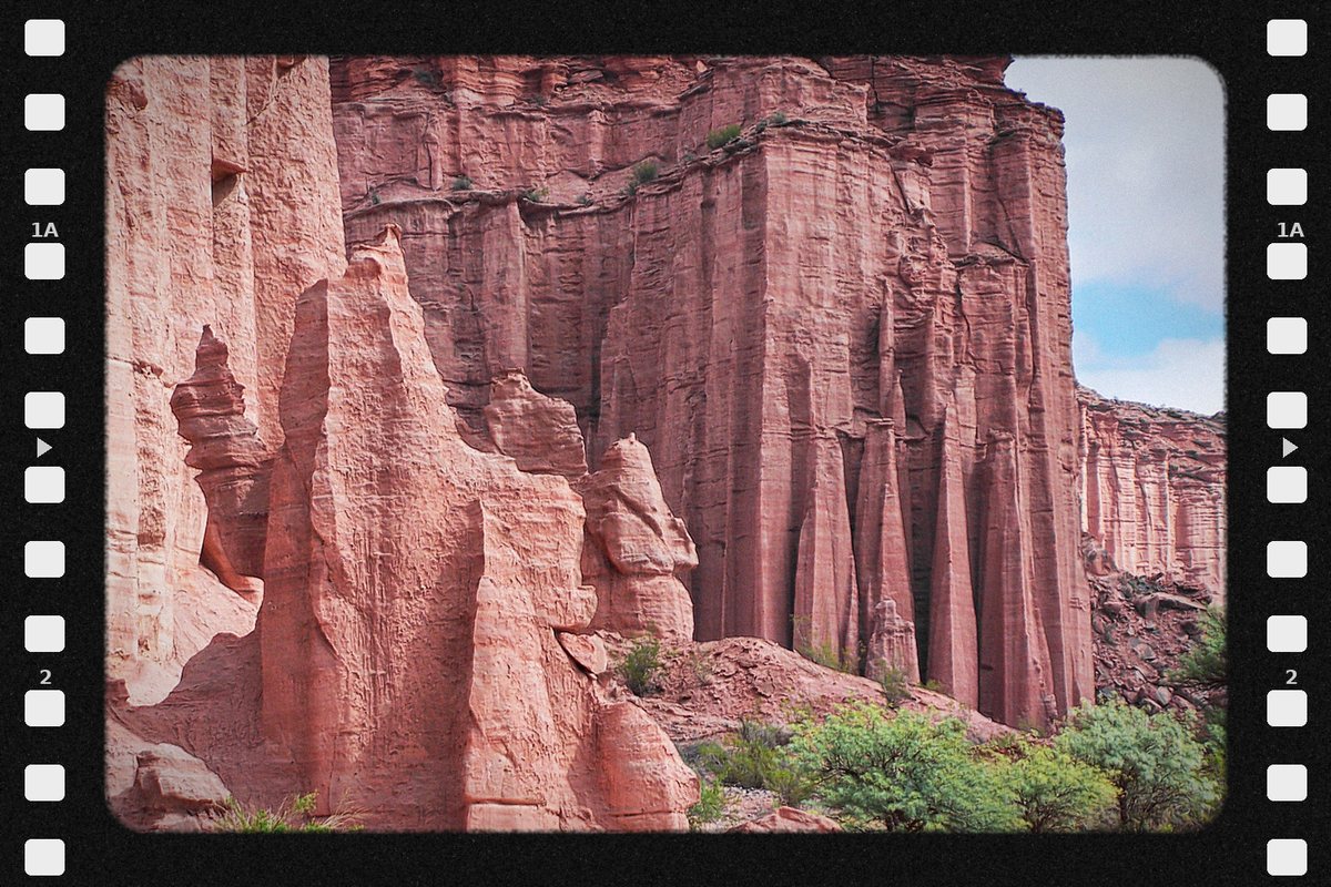
La Rioja, land of red stone and wind. The canyons of Talampaya hold dinosaur tracks and ancient petroglyphs, and the Famatina watches over the valleys. In Aimogasta the Arauco olive is born, unique in the world, and in Chilecito, Riojan Torrontés perfumes the vineyards. Land of caudillos, of the Tinkunaco and the chaya, and of the Syrian and Lebanese immigration that leaves its flavor and its surnames. La Rioja is not rushed: it is contemplated. La Rioja is silence that speaks.

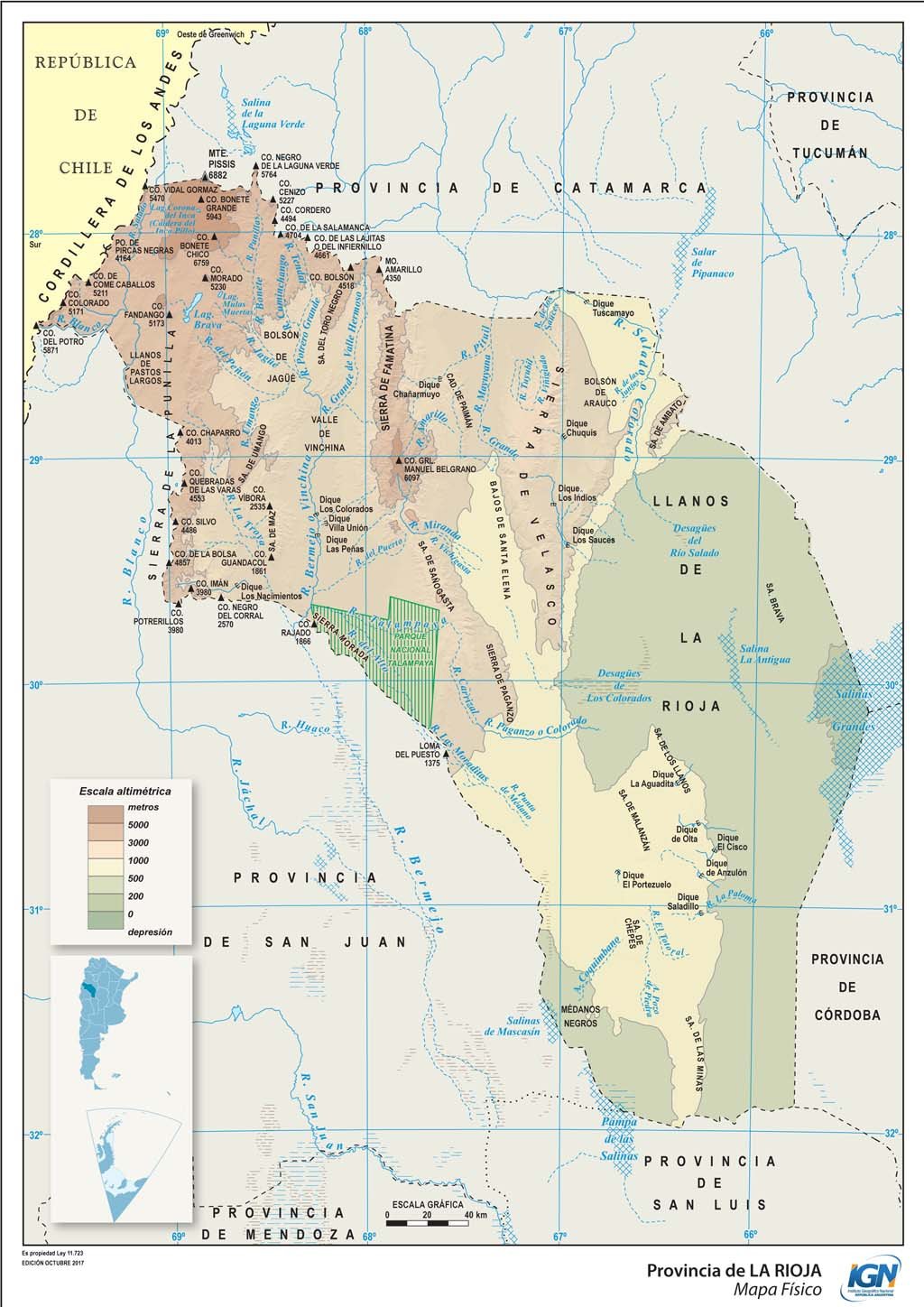
Political map · Source: IGN
- Capital
- La Rioja
- Region
- Northwest
- Area
- 89,680 km²
- Population · 2022 Census
- 383,865 inhabitants · 4.3 hab/km²
- Women · Men
- 51.2 % · 48.8 %
- Median age
- 30 years
- By age
- 0 to 14 years: 22.1 % · 15 to 64 years: 68.8 % · 65 years and over: 9.1 %
- Climate
- Arid and semi-arid; temperate and dry in the valleys; cold at altitude in the Andes.
- Demonym
- riojano/a
- Founding of the capital
- 20 May 1591
- World Heritage (UNESCO)
- Parques Naturales Ischigualasto / Talampaya (2000) · Qhapaq Ñan, Sistema Vial Andino (2014)
- Status
- Province predating the 1853 National Constitution
- Departments
- 18
- Born in another province · abroad
- 18.2 % · 1.5 %
Sources: INDEC, 2022 National Census (final results) · INDEC / IGN (area). World Heritage: UNESCO, World Heritage List · Provincialization laws · IGN (political division).
- Mean annual temperature
- 20.3 °C
- Annual rainfall
- 410 mm
- Mean maximum · warmest month
- 35.4 °C · January
- Mean minimum · coldest month
- 4.2 °C · July
Source: Servicio Meteorológico Nacional (SMN), climatological standard normals 1991–2020, station La Rioja Aero, submitted to the World Meteorological Organization.
- Highest point
- Cerro Bonete Chico · 6,759 m · in the Andes
- Main rivers
- Vinchina · Bermejo · Los Sauces
- Ecoregions
- High Andes · Puna · Monte of Sierras and Bolsones · Dry Chaco
- Main cities
- La Rioja · Chilecito · Aimogasta · Chamical · Chepes
Sources: Instituto Geográfico Nacional (IGN), highest elevations · Secretaría de Infraestructura y Política Hídrica de la Nación, river basins · Ministerio de Ambiente de la Nación, ecoregions of Argentina · INDEC, 2022 National Census (population by department).
- Provincial flower
- Cardón cactus flower · Ley 6.581 (1998) · celebrated on 20 October
- Species protected by law
- Southern tamandua · Ley 8.301 · protected species throughout the province
Sources: Boletín Oficial de La Rioja · Gobierno de La Rioja, Dirección General de Conservación de la Biodiversidad.
- Hotel guests · 2024
- 46,362 in La Rioja · 3.3 % from abroad
- National park
- Talampaya
Sources: INDEC and Secretaría de Turismo de la Nación, Hotel Occupancy Survey (hotels and other lodgings) · Administración de Parques Nacionales.
- Airport
- Capitán Vicente Almonacid · 78,037 passengers in 2025
- Scheduled flights · 2025
- Aeroparque 66,996 · San Fernando del Valle de Catamarca 7,597 · Ezeiza 3,444 passengers
- National routes
- RN 38 · RN 40 · RN 60 · RN 73 · RN 74 · RN 75 · RN 76 · RN 77 · RN 78 · RN 79 · RN 141 · RN 150
- International border crossings
- Chile 1 (Pircas Negras)
Sources: Secretaría de Turismo de la Nación, Air connectivity, with ANAC data · Instituto Geográfico Nacional (IGN), national road network and international crossings.
- From La Rioja to the City of Buenos Aires, by road
- 1,150 km
To the other provincial capitals, by road
- San Fernando del Valle de Catamarca 156 km
- Santiago del Estero 360 km
- San Miguel de Tucumán 388 km
- Córdoba 435 km
- San Juan 450 km
- San Luis 550 km
- Mendoza 617 km
- Salta 695 km
- Santa Fe 765 km
- San Salvador de Jujuy 770 km
- Paraná 796 km
- Resistencia 970 km
- Corrientes 993 km
- Santa Rosa 1,035 km
- Formosa 1,136 km
- La Plata 1,189 km
- Posadas 1,308 km
- Neuquén 1,472 km
- Viedma 1,629 km
- Rawson 1,890 km
- Río Gallegos 3,070 km
- Ushuaia 3,663 km
Source: Government of the Argentine Republic (argentina.gob.ar), road distances between provincial capitals.
- National festivals
- Fiesta Nacional de la Chaya · February
Sources: Gobierno de La Rioja · Honorable Cámara de Diputados de la Nación.
- Share of the national economy · 2024
- 0.5 % · rank 23 of 24
- Growth 2004–2024
- +28 % · the country, +42 %
- Main activities
- Trade 14.8 % · Public administration 12.9 % · Public education 8.4 % · Food and beverages 7.0 %
Source: ECLAC and Ministerio de Economía de la Nación, Provincial breakdown of gross value added, 2004 base (2023 and 2024, preliminary data).
Natural wealth
The territory that defines it
La Rioja is red stone, wind and silence. In Talampaya National Park, sandstone walls carved over millions of years hold Triassic fossils and petroglyphs of ancient inhabitants; together with Ischigualasto, in San Juan, it forms a UNESCO World Heritage Site. High in the Andes, the Laguna Brava Reserve, a Ramsar site, shelters flamingos and vicuñas at more than 4,000 meters. The Famatina massif dominates the valleys of Chilecito and Famatina, and to the east open the Sierra de Velasco, the Cuesta de Miranda and the plain of Los Llanos.
- Parque Nacional Talampaya (1997)
Source: Argentine National Parks Administration (SIB-APN).
- Reserva Provincial Laguna Brava (2003) · 405,000 ha
Source: Argentine Undersecretariat of Environment, Ramsar Sites Network. Official year of designation and area.
Inaugurated in 1904 and completed in 1905, it carried gold, silver and copper ore down from the La Mejicana mine, in the Famatina, to the Chilecito station: a 34.3-kilometer route, nine stations and a drop of 3,345 meters. Built by the German firm Bleichert, it was one of the great engineering works of its time and operated until 1927. It is a National Historic Monument, and its Station 1 is now a museum.
Source: Government of the Argentine Republic, National Monuments Commission.
Human wealth
The living figures
La Rioja is faith and celebration. Every 31 December, the Tinkunaco brings together Saint Nicholas of Bari and the Niño Alcalde in the square in a rite of encounter born of Diaguita history. In February, the Chaya, its carnival, celebrates the harvest with basil, flour and vidalas. The Riojan table is one of olives, walnuts, empanadas, kid goat and homemade sweets, accompanied by Riojan Torrontés, the emblematic grape of its valleys.
- Before the conquest · Diaguita peoples inhabit the valleys and leave their petroglyphs in Talampaya; the Inca Empire incorporates the territory into the Qhapaq Ñan
- 1591 · Juan Ramírez de Velasco founds the city of Todos los Santos de la Nueva Rioja
- 1593 · according to tradition, Saint Francis Solano mediates peace between the Diaguita and the Spanish: the origin of the Tinkunaco, which the city celebrates at the end of every year
- 19th century · the caudillos Juan Facundo Quiroga and Ángel Vicente "Chacho" Peñaloza, born in Los Llanos, shape national history
- 1905 · Joaquín V. González, a Riojan born in Nonogasta, founds the Universidad Nacional de La Plata
Sources: Government of the Province of La Rioja · Universidad Nacional de La Plata.
10,645 people identify as Indigenous or as descendants of Indigenous or native peoples: 2.8 % of the province's population. They belong to 37 different peoples, and 1,535 (14.4 %) speak or understand the language of their people. The five largest peoples are:
- Diaguita · 4,285
- Quechua · 244
- Diaguita Cacano · 229
- Guaraní · 165
- Mapuche · 158
Source: INDEC, 2022 National Population, Household and Housing Census, final results. Population in private dwellings.
Productive wealth
What it produces and exports
La Rioja is a land of olive trees, vineyards and walnut groves. Olive oil and olives lead its exports, winemaking places it as the country's third province, and tourism in Talampaya and the Famatina grows year after year. Brazil is today its main export destination.
USD 163 million, 25.7 % less than in 2024: 0.2 % of the national total and 3.3 % of the Northwest.
- Manufactures of agricultural origin · USD 115 M
- Manufactures of industrial origin · USD 41 M
- Primary products · USD 7 M
Main destinations: Brazil (USD 52 M, 32.1 %), Chile (USD 32 M), United States (USD 28 M) and European Union (USD 16 M). Main products: vegetable, pulse and fruit preparations (USD 59 M), fats and oils (USD 35 M), paper, paperboard, printed matter and publications (USD 32 M) and dried or processed fruit (USD 12 M).
Source: INDEC, Provincial origin of exports. Goods. Year 2025 (provisional data) and annex tables.
Vegetable and fruit preparations, including olives (USD 59 M), and fats and oils (USD 35 M) were its main exports in 2025. In Aimogasta stands the Historic Olive Tree of Arauco, considered the oldest in the country and declared a National Historic Monument.
Sources: INDEC, Provincial origin of exports 2025 · National Monuments Commission.
7,010 hectares of vines in 1,001 vineyards: 3.5 % of the country's area, the third wine-producing province after Mendoza and San Juan. Riojan Torrontés is its flagship grape, centered in Chilecito and the Famatina valleys.
Source: Instituto Nacional de Vitivinicultura (INV), 2024 annual vineyard area report.
CONICET has one research unit in the province, the Regional Center for Scientific Research and Technology Transfer (CRILAR), in Anillaco, together with the Universidad Nacional de La Rioja and the Universidad Nacional de Chilecito.
Source: CONICET, 2025 Management Report.
Space to embed one or more 45s–1min capsules about the province.
To experience it on the ground — restaurants, hotels, events, geolocation — the app.
Open the Argentina al Mundo app