Santa Cruz
Explora Nuestras Provincias y sus Riquezas is part of Argentina al Mundo, alongside Argentine Delights, Guía AD-Gourmet and Chefs Argentinos al Mundo.
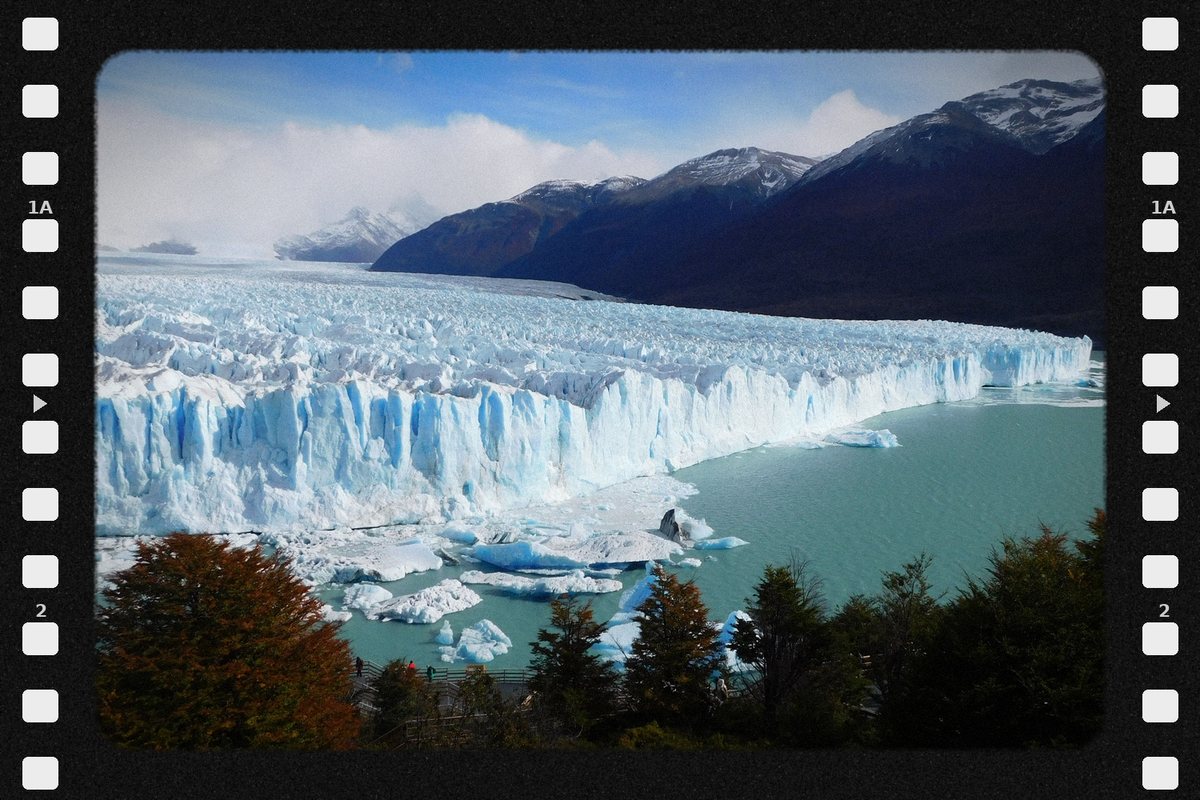
Santa Cruz, Patagonia at its grandest scale. The Perito Moreno Glacier bursts into Lago Argentino, and in El Chaltén, the National Trekking Capital, Fitz Roy and Cerro Torre challenge climbers from all over the world. On the plateau, the Cave of the Hands holds paintings more than nine thousand years old. Coasts of penguins and sea lions, pioneer estancias and lamb roasted on the cross. Santa Cruz is not toured: it is conquered step by step. Santa Cruz is the ice and the wind at the end of the world.

Political map · Source: IGN
- Capital
- Río Gallegos
- Region
- Patagonia
- Area
- 243,943 km²
- Population · 2022 Census
- 337,226 inhabitants · 1.4 hab/km²
- Women · Men
- 50.4 % · 49.6 %
- Median age
- 31 years
- By age
- 0 to 14 years: 24.3 % · 15 to 64 years: 68.3 % · 65 years and over: 7.4 %
- Climate
- Cold, arid and semi-arid, windy; cool temperate and humid in the Andes.
- Demonym
- santacruceño/a
- Founding of the capital
- 19 December 1885
- World Heritage (UNESCO)
- Parque Nacional Los Glaciares (1981) · Cueva de las Manos, Río Pinturas (1999)
- Status
- Province since 1955 · Ley 14.408
- Departments
- 7
- Born in another province · abroad
- 39.0 % · 6.6 %
Sources: INDEC, 2022 National Census (final results) · INDEC / IGN (area). World Heritage: UNESCO, World Heritage List · Provincialization laws · IGN (political division).
- Mean annual temperature
- 7.7 °C
- Annual rainfall
- 277 mm
- Mean maximum · warmest month
- 20.0 °C · January
- Mean minimum · coldest month
- -2.3 °C · July
Source: Servicio Meteorológico Nacional (SMN), climatological standard normals 1991–2020, station Río Gallegos Aero, submitted to the World Meteorological Organization.
- Main rivers
- Santa Cruz · Deseado · Chico · Gallegos · Coyle
- Ecoregions
- Patagonian Forests · Patagonian Steppe
- Main cities
- Río Gallegos · Caleta Olivia · Pico Truncado · El Calafate · Puerto Deseado
Sources: Secretaría de Infraestructura y Política Hídrica de la Nación, river basins · Ministerio de Ambiente de la Nación, ecoregions of Argentina · INDEC, 2022 National Census (population by department).
- Provincial natural monuments
- Huemul · Ley 2.103
Hooded grebe · Ley 2.582 (2001)
Andean condor · Ley 2.996 (2006)
Sources: Honorable Cámara de Diputados de Santa Cruz · Ministerio de Ambiente de la Nación.
- Hotel guests · 2024
- 540,423 in the surveyed towns: El Calafate 457,815 · Río Gallegos 82,608 · 33.7 % from abroad
- National parks
- Los Glaciares · Perito Moreno · Monte León · Bosques Petrificados de Jaramillo · Patagonia
Sources: INDEC and Secretaría de Turismo de la Nación, Hotel Occupancy Survey (hotels and other lodgings) · Administración de Parques Nacionales.
- Airports · passengers 2025
- Comandante Armando Tola 904,834 · Internacional Piloto Civil Norberto Fernández 129,339 · Jalil Hamer 1,388
- Scheduled flights · 2025
- Aeroparque 415,184 · Ezeiza 222,525 · Ushuaia 182,651 · San Carlos de Bariloche 46,888 passengers
- National routes
- RN 3 · RN 40 · RN 281 · RN 288 · RN 293
- International border crossings
- Chile 16
Sources: Secretaría de Turismo de la Nación, Air connectivity, with ANAC data · Instituto Geográfico Nacional (IGN), national road network and international crossings.
- From Río Gallegos to the City of Buenos Aires, by road
- 2,635 km
To the other provincial capitals, by road
- Ushuaia 593 km
- Rawson 1,180 km
- Viedma 1,675 km
- Neuquén 1,930 km
- Santa Rosa 2,035 km
- San Luis 2,540 km
- La Plata 2,551 km
- Córdoba 2,635 km
- Mendoza 2,800 km
- Santa Fe 2,845 km
- San Juan 2,860 km
- Paraná 2,876 km
- Santiago del Estero 3,065 km
- La Rioja 3,070 km
- San Fernando del Valle de Catamarca 3,075 km
- San Miguel de Tucumán 3,225 km
- Corrientes 3,367 km
- Resistencia 3,390 km
- Salta 3,532 km
- Formosa 3,558 km
- San Salvador de Jujuy 3,565 km
- Posadas 3,675 km
Source: Government of the Argentine Republic (argentina.gob.ar), road distances between provincial capitals.
- National festivals
- Fiesta Nacional de la Cereza · January · Los Antiguos
Fiesta Nacional del Trekking · March · El Chaltén
Fiesta Nacional del Carbón · December · Río Turbio - Traditional festivals
- Fiesta del Lago Argentino · February · El Calafate
Fiesta Cueva de las Manos · February · Perito Moreno
Festival Austral del Folklore · October · Pico Truncado
Sources: Ley nacional 27.055 · Res. Secretaría de Turismo de la Nación 609/1994 · Ley nacional 26.910 · Ley provincial 3.270 · Ley provincial 964 · argentina.travel.
- Share of the national economy · 2024
- 1.4 % · rank 14 of 24
- Growth 2004–2024
- +7 % · the country, +42 %
- Main activities
- Oil and gas 24.7 % · Metal mining 14.2 % · Public administration 8.9 % · Fishing 7.5 %
Source: ECLAC and Ministerio de Economía de la Nación, Provincial breakdown of gross value added, 2004 base (2023 and 2024, preliminary data).
Natural wealth
The territory that defines it
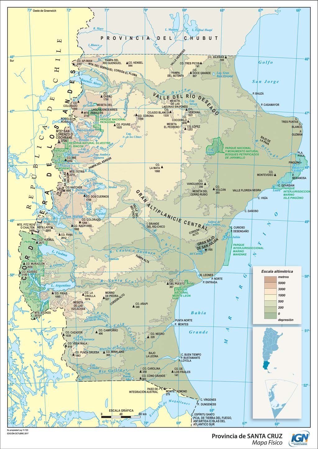
Santa Cruz is Patagonia at its largest scale: the country's second-largest province and one of the least populated. To the west, the Patagonian Andes and the Southern Patagonian Ice Field, shared with Chile, the largest continental ice reserve in the southern hemisphere outside Antarctica, discharge glaciers into turquoise lakes such as Lago Argentino, the largest lake entirely within Argentina. In the center, the plateau of wind and steppe; in the east, a coast of cliffs, estuaries and penguin colonies on the Atlantic.
- Parque Nacional Los Glaciares (1937)
- Parque Nacional Perito Moreno (1937)
- Parque Nacional Bosques Petrificados de Jaramillo (1954)
- Parque Nacional Monte León (2004)
- Parque Nacional Patagonia (2015)
Source: Argentine National Parks Administration (SIB-APN).
- Perito Moreno Glacier · the most famous in Los Glaciares National Park, a World Heritage Site since 1981; its front, about 60 meters high, and its ruptures make it one of the great natural spectacles on the planet
- El Calafate · on the shores of Lago Argentino, gateway to the Perito Moreno, Upsala and Spegazzini glaciers
- El Chaltén · the National Trekking Capital, at the foot of Fitz Roy and Cerro Torre, a world mecca for mountaineering
- Lago del Desierto and Perito Moreno National Park · forests, lakes and mountains of the most remote Patagonia
Sources: Argentine National Parks Administration · UNESCO · Government of Santa Cruz.
- Cave of the Hands · in the canyon of the Pinturas River, a World Heritage Site since 1999: hundreds of hands painted by hunters more than 9,000 years ago
- Jaramillo Petrified Forests · petrified araucaria trunks some 150 million years old
- Ría Deseado · a refuge for the rockhopper penguin, the red-legged cormorant and Commerson's dolphins, next to Puerto Deseado
- Monte León National Park · the country's first coastal-marine national park, with penguin colonies, sea lions and cliffs
- Patagonia National Park · protects the plateau of Lake Buenos Aires, habitat of the hooded grebe, a bird that lives only in Santa Cruz
Sources: Argentine National Parks Administration · UNESCO.
Human wealth
The living figures
Santa Cruz is a land of estancias, pioneers and travelers. The Tehuelche heritage coexists with that of the British, Spanish and Chilean settlers who populated the steppe with sheep, and with today's miners, oil workers and fishermen. Its estancias, open to tourism, tell that story. At the table, Patagonian lamb roasted on the cross, king crab, the calafate —the shrub that gives El Calafate its name and that, legend says, ensures the return of whoever tastes its fruit— and trout from its lakes.
- More than 9,000 years ago · the first hunters paint the Cave of the Hands; their heirs, the Tehuelche or Aonikenk, roamed the steppe for millennia
- 1520 · Ferdinand Magellan winters in the bay of San Julián, where the first mass in present-day Argentine territory is celebrated
- 1885 · Río Gallegos, today the capital, is founded
- 1920-1921 · the strikes of rural workers, known as Rebel Patagonia, are crushed by the Army, one of the most tragic episodes in Patagonian history
- 1957 · Santa Cruz becomes a province
Sources: Government of Santa Cruz · General Archive of the Nation.
12,525 people identify as Indigenous or as descendants of Indigenous or native peoples: 3.7 % of the province's population. They belong to 47 different peoples, and 2,258 (18.0 %) speak or understand the language of their people. The five largest peoples are:
- Mapuche · 3,245
- Tehuelche · 1,776
- Mapuche Tehuelche · 1,016
- Diaguita · 708
- Quechua · 611
Source: INDEC, 2022 National Population, Household and Housing Census, final results. Population in private dwellings.
Productive wealth
What it produces and exports
Santa Cruz is the great province of gold and silver: metal mining accounts for more than two thirds of its exports. It adds oil and gas in the San Jorge Gulf and Austral basins, the country's only coal mine in Río Turbio, deep-sea fishing, sheep farming and world-class tourism in the glaciers. The United States is today its main export destination.
USD 2,953 million, 30.2 % more than in 2024: 3.4 % of the national total and 23.4 % of Patagonia.
- Manufactures of industrial origin · USD 2,094 M
- Primary products · USD 437 M
- Fuels and energy · USD 347 M
- Manufactures of agricultural origin · USD 75 M
Main destinations: United States (USD 901 M, 30.5 %), European Union (USD 292 M), Chile (USD 152 M) and China (USD 48 M). Main products: precious stones and metals and their manufactures, coins (USD 2,090 M), metal ores, slag and ash (amount withheld for statistical confidentiality), crude oil (USD 282 M) and unprocessed fish and seafood (USD 114 M).
Source: INDEC, Provincial origin of exports. Goods. Year 2025 (provisional data) and annex tables.
Precious stones and metals accounted for USD 2,090 M in exports in 2025, 71 % of the provincial total. Mines such as Cerro Vanguardia, Cerro Negro, San José and Cerro Moro operate in the Deseado Massif.
Sources: INDEC, Provincial origin of exports 2025 · Argentine Secretariat of Mining.
Crude oil accounted for USD 282 M in exports in 2025. In Río Turbio, in the far southwest, operates the country's only active coal mine.
Sources: INDEC, Provincial origin of exports 2025 · Yacimientos Carboníferos Río Turbio.
Unprocessed fish and seafood accounted for USD 114 M in exports in 2025, with Puerto Deseado as the province's main fishing port.
Source: INDEC, Provincial origin of exports 2025.
Data on mining and hydrocarbons is included for information purposes only, as part of the province's productive profile. Explora Nuestras Provincias y sus Riquezas does not promote extractive activity.
Space to embed one or more 45s–1min capsules about the province.
To experience it on the ground — restaurants, hotels, events, geolocation — the app.
Open the Argentina al Mundo app